Example Features
North African Nozzle
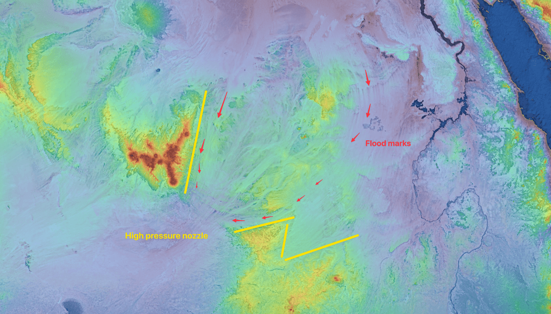
North Africa shows clear evidence of a mega-floods. When
A sophisticated mapping tool designed to analyze how mega-floods shaped our planet. Explore the geological evidence of Pole Shifts, Meltwater Pulses, ECDO, and other earth-changing events through detailed elevation visualizations.
North Africa shows clear evidence of a mega-floods. When